                         /\4000' SUMMITS
                    /\  //\\in the White Mountains,
             /\    //\\///\\\        /\the Adirondacks,
            //\\  ///\////\\\\  /\  //\\ Vermont & Maine
 /\        /  ^ \/^ ^/^  ^  ^ \/^ \/  ^ \
/ ^\  /\  / ^   /  ^/ ^ ^ ^   ^\ ^/  ^^  \
/\
.::/48\::.
4000' Peaks in the White Mountains
MOUNTAIN ELEV. DATE TRAILS SUMMIT BREW MOUNTAINEERS 1 Washington 6288' 1985-2011 Ammonoosuc Ravine, Crawford, Jewell Pabst Blue Ribbon Spil, Jose, Dave, Marlene, MD, Sherry, the Peruz, the Nudz 2 Adams 5774' Aug 24, 2003 Airline, Valley Way, King Ravine Fosters Special Bitter Kate, Big Nude Mike, Matty, Devo 3 Jefferson 5712' 1983,2003,2004,2005,2013 Caps Ridge Fishbrook Equinox IPA,Spiky IPA Lou, Quarter, Spil & Chrissie, Bobby Peru, Big Nude, Matty 4 Monroe 5384' June 2, 2003 Ammonoosuc Ravine, Crawford, Jewell 5 Madison 5367' Aug 24, 2003 Airline, Valley Way 6 Lafayette 5260' 1988,2005,2011,2015 Falling Waters, Franconia Ridge, Greenleaf, Old Bridle Path Pabst Blue Ribbon, Sierra Harvest IPA MD, the Nudz, Jeannie 7 Lincoln 5089' 2005, 2011, 2015 Falling Waters, Franconia Ridge, Greenleaf, Old Bridle Path Fosters Premium Ale the Nudz: Mike & Kate 8 South Twin 4902' Sept 4, 2003 North Twin, North Twin Spur Foster's Special Bitter 9 Carter Dome 4832' June 13, 2005 Carter-Moriah, 19 Mile Brook (traverse) Foster's Premium Ale (9/19/09) 10 Moosilauke 4802' April 18, 2004, August 19, 2012 Beaver Brook Trail Fishbrook Equinox IPA, Ipswich Harvest IPA Tiffany, Skip, Matthew 11 Eisenhower 4761' July 20, 2003 Crawford Path, Edmunds Path Fosters Special Bitter 12 North Twin 4761' Sept 4, 2004 North Twin, North Twin Spur 13 Bond 4698' 2007,2010 North Twin, Bondcliff 14 Carrigain 4700' May 7, 2006 Signal Ridge Trail Guinness Draft 15 Mid. Carter 4610' June 13, 2005 Carter-Moriah, 19 Mile Brook (traverse) 16 West Bond 4540' Sept 30, 2007 North Twin, Bondcliff 17 Garfield 4500' June 5, 2005 Garfield Trail 18 Liberty 4459' Sept 11, 2005,2016 Falling Waters, Franconia Ridge, Greenleaf, Old Bridle Path/ Liberty Springs Moat Mountain Intervale IPA MD, the Nudz, Jeannie 19 South Carter 4430' June 13, 2005 Carter-Moriah, 19 Mile Brook (traverse) 20 Wildcat 4422' Oct 22, 2006 19 Mile Brook, Wildcat Ridge Bear Republic Hop Rod Rye 21 Hancock 4403' August 13, 2006 Hancock Notch, Cedar Brook, Hancock Loop Fishbrook Pale Ale 22 S. Kinsman 4358' May 28, 2006 Lonesome Lake, Fishin' Jimmy, Kinsman Ridge Tod Mott Saison 23 Osceola 4340' May 14, 2005 Greeley Ponds, Mt. Osceola Trail Smuttynose IPA MD/Sherry,MD,Danielle,the Nudz 24 Flume 4328' April 29, 2006 Lincoln Woods, Osseo Trail Fishbrook Fat Tuesday Ale 25 Field 4326' Aug 6, 2005 Avalon, Willey Range Trail, A-Z Trail Fosters Special Bitter 26 Pierce 4310' July 20, 2003 Crawford Path Fishbrook Pale Ale 27 Willey 4302' Aug 6, 2005 Avalon, Willey Range Trail, A-Z Trail 28 N. Kinsman 4293' May 28, 2006 Lonesome Lake, Fishin' Jimmy, Kinsman Ridge Pabst Blue Ribbon 29 S. Hancock 4274' May 2002 Hancock Notch, Cedar Brook, Hancock Loop Fosters Lager 30 Bondcliff 4265' Sept 30, 2007 North Twin, Bondcliff Fishbrook No Quarter Porter 31 Zealand 4260' Sept 2, 2006 Zealand Trail, Twinway Fishbrook Pale Ale 32 Cabot 4170' Oct 15, 2006 Unknown Pond Trail, Kilkenny Ridge Trail Fishbrook Pond Oktoberfest 33 East Osceola 4156' May 14, 2005 Greeley Ponds Trail, Mt. Osceola Trail MD 34 N Tripyramid 4140' 2005, 2013 Livermore, North Slide, South Slide, Tripyramid Fishbrook Ten Toes Centennial IPA 35 M Tripyramid 4110' 2005, 2013 Livermore, North Slide, South Slide, Tripyramid Victory Prima Pils, PBR 36 Cannon 4100' April 17, 2005 Kinsman Ridge up, ski slope down Fishbrook Bent String Brown 37 Passaconaway 4060' Sept 24, 2005 Blueberry Ledge, Rollins, Walden, Old Mast Sam Adams Black Lager 38 Hale 4054' Aug 28, 2004 Hale Brook Trail 39 Jackson 4052' Aug 31, 2003 Webster-Jackson, Jackson Brook, Webster Cliff 40 Moriah 4049' June 13, 2005 Carter-Moriah, 19 Mile Brook (traverse) 41 Tom 4047' Aug 6, 2005 Avalon, Willey Range Trail, A-Z Trail 42 Wildcat E 4041' June 18, 2006 Lost Pond Trail, Wildcat Ridge Trail Fosters Special Bitter 43 Owl's Head 4025' July 31, 2005 Lincoln Woods, Black Pond, bushwhack, Lincoln Brook, Owl's Head Fosters Special Bitter Matty D 44 Galehead 4024' July 30, 2006 Gale River Trail, Frost Trail Fishbrook Pale Ale 45 Whiteface 4010' Sept 24, 2005 Blueberry Ledge, Rollins, Walden, Old Mast Sam Adams Black Lager 46 Waumbek 4006' April 8, 2006 Starr King Trail Fishbrook Fat Tuesday Ale 47 Isolation 4005' Sept 10, 2011 Glen Boulder,Davis Path,Isolation,Rocky Branch Sixpoint 'The Crisp', PBR Kate, Big Nude, Chrissie, Peru & JB 48 Tecumseh 4003' June 27, 2004 Mount Tecumseh Trail Fosters Lager,Fishbrook Imperial Saaz Kate, Big Nude
MOUNTAIN ELEV. DATE TRAILS SUMMIT BREW Starr King 3915' April 8, 2006 Starr King Trail Fishbrook Fat Tuesday Ale Chocorua 3500' March 19, 2006 Champney Falls Trail Fat Tuesday Ale Monadnock 3165' March 19, 2005, 2006, 2009 White Dot - White Cross Fat Tuesday Ale, Fishbrook Hefeweisen Pack Monadnock 2290' March 27, 2013 Marion Davis Trail, Wapack Trail
/\
.::/48\::.
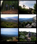
(December 3, 2013) This is not only a scorecard but a collection of notes, mostly written shortly after the hike, some during, and recollections thereafter. Some links to pictures and (not enough!) memories from my shy mountaineering friends. Many peaks were scaled years ago, before the advent of the pencil. At this point, the classic hikes are being moved to the top, followed by the biggies, mountains that have been visited many times, and then chronologically, from 2004 onward. (When I started keeping better notes.) -- JB
.:: reflectin' on 48 ::.
(Cinco de Mayo 2012) As I retire to the couch, I look back upon my peakbagging conquests fondly. Jimmy Spil showed me the ropes here early on, we climbed Jefferson via the Caps Ridge and Tres Hombres de la Montańa conquered Washington. Some treks were difficult, whether it was the elements or my state of mind. Some short and easy. The traverses
were always challenging, I never felt I was quite in the best shape for these long hauls, but whaddya gonna do, turn around? The Moonlight Presidential Traverse Matty D and I did was unbelievable. I was wobble-legged after sunup, and thank goodness for a nap on the col (and MD's forgiveness) it turned out to be the longest and one of the very finest hikes I've ever done. Matt and I also traversed the Carter-Moriah Range. Sweet, despite the black flies and fog early on.
The Bonds Traverse is another classic, done twice with my bestest hikin' crew, the Nudz, the Perus, the Demereskins. First time was in 2007 with the Admirals, MD, Peru & I, then again in 2010 when Kate, Mike, Matty, Chrissie, Peru & I footed rock. A fine, fine trek.
Bobby Peru was the first of our crowd to summit all 48. Many moons ago. And a guiding light. Knows the Whites (and IPAs) as well as anyone. And a helluva good time on the mountain. ('Cept when he's cold...)
Mt. Adams (5774' #2) via King Ravine - one of my all-time favorites. Devo was hankering for a real White Mountain climb, and he got one. Was socked in for the most part, and a difficult endeavor in any weather. Probably one of the hardest trails in the Whites. Subway killed my camera. Had us some Stone Ruination IPA & Talisker 18 scotch on the summit. Not too shoddy. And some Iron Mike at the Moat Mountain Brewery afterwards.
Tripyramids (4140') was another eyeopener. Gorgeous trail, openface rock with much hand-over-foot, just a bustin' experience. On that day Kate saved the day. Talking a friend of ours through her fear of heights and escorting her down with MD.
#48 was Isolation. A grand mountain and an appropriate finale. The Nudz & the Perus joined me for my final feather. We had a great celebration on top, some Sixpoint Crisp & PBR, and I was applauded by other summiters. Pretty cool. Then came the 2012 AMC 4000 FOOTER AWARDS, which were a tad long, but attended by my great crew. And capping it was a Group 5 song Big Nude Mike wrote called "I Climbed Every Mountain" that has become a staple of the ceremony.
As it's all about the numbers, 48 bein' the prime, gotta count the beers (guys hate when their wives do this) we had on the summit.
"I'll go tally the votes...."
"I'll go tally the votes...."

FISHBROOK POND (homebrew)  19!
FOSTERS                    10
PABST BLUE RIBBON          5
SAM ADAMS                  2

and 1 each of Ipswich, Guinness, Smuttynose, Victory, Bear Republic & Sixpoint.
Surprised my homebrew topped the charts. But that is kinda the theme to Fishbrook Pond Brewing Company. Fresh brewed. Field tested. Since 2002. But 6 mountains without beer? My new list!
.:: 2005 MOONLIGHT MIDNIGHT PRESIDENTIAL TRAVERSE...::!::.
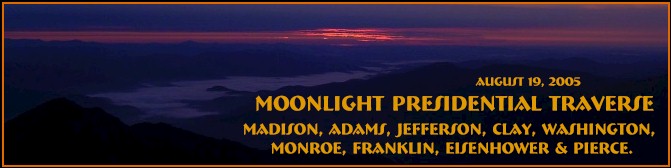
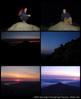
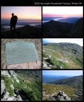
(August 19, 2005) Under a full moon... A Moonlight Presidential Traverse in the Whites - the whole enchalada. An hellacious undertaking! A seed was planted when we read of hiking under a full moon and watching sunrise (Cue in Yardbirds' 'Roger the Engineer') from the mountaintop. (And, naturally, the late-great Bobby Peru's tales of truth & wonder.) Shortly after midnight the mountaineers (Matty D & JB) departed Appalachia. Crisp in the 40's, we followed the Valley Way Trail, climbing Madison & Adams in the dark. Used flashlights until we neared treeline. (The stylin' yet practical Matty D used a headlamp.)
Reached the summit of Adams in time for sunrise, a mahvelous sight. Then, after a much needed JB snore on a high meadow, we were collected by the amiable John from Philly who had hit trail about 2am. He joined us on and off for the rest of the endeavor. It was onto Jefferson, Clay, Washington, Monroe, Franklin, Eisenhower & Pierce. On the summit of Mt. Pierce, a small celebration ensued. The traditional oilcan of Foster's Special Bitter was tapped, and sandwiches were shared with the rambunctious Gray Canadian Jays. (Dap to Philly John who continued on over Jackson & Webster.) Four sore feet and almost 18 hours later we stumbled into Crawford Notch. Geez, sounds easy enough now. About 20 miles and 10,000 feet of gain.
(September 1, 2005) Two weeks ago, as fate would have it, Matt & myself were finishing off a Tuckerman Pale Ale at Truant's Tavern in Lincoln and heading north towards trailhead. Had many concerns at this point in time. Matty D was, as always, in tip-top shape. My mountain legs were as good as they've been in a long while - we traversed the Moriah-Carter Range a month earlier, and trekked some serious miles this season. 11 mountain trips this year for me before this one. My main concern was skipping a sleep cycle. And it kicked my sorry butt early on. By the time we reached Thunderstorm Junction on the southern slope of Adams, I was sleepwalking. My legs were jelly. Matty D was sayin, "Don't be a pussy, you f*ckin' pussy!!" Not really, but I seriously wasn't gonna make it without some shuteye. After a snooze I wuz done reborned. Felt pretty doggone strong fer the rest of the haul.
When we reached Mt. Washington, we fueled up with a sitdown meal of chili & pizza. And Coke for me - I suddenly remembered my caffeine addiction! The mobscene didn't faze us on this day. Although it did stop us from tagging the actual summit. (This technicality makes the traverse officially unofficial. 18 hours wasted.) From this point on we encountered many hikers & hut-folks. An epic hike - just incredible. Miserable as I felt early on, after sunrise and a nap I loved every minute of it. Almost... -- JB
Trail                  Destination                  Miles   Guidetime

VALLEY WAY             to MADISON HUT                 3.8      3:40
OSGOOD TRAIL           to MADISON SUMMIT              4.3      4:10
                  back to MADISON HUT                 4.8      4:40
STAR LAKE TRAIL        to ADAMS                       5.8      5:40
LOWES PATH             to GULFSIDE                    6.1      6:00
GULFSIDE             from THUNDERSTORM JCT.
                       to JEFFERSON LOOP              7.6      6:55
                       to JEFFERSON SUMMIT            8.0      7:25
                  down to GULFSIDE TRAIL              8.4      7:55
GULFSIDE (the Cornice) to MT. CLAY LOOP              10.1      9:00
                       to WASHINGTON SUMMIT          11.2     10:00
CRAWFORD PATH          to LAKES of the CLOUDS HUT    12.7     11:25
                       to MT. MONROE LOOP            13.4     11:55
                       to EISENHOWER LOOP south      15.4     13:15
                       to MT. PIERCE SUMMIT          16.8
                       to SACO LAKE (Crawford Notch) 20.1     17:40
.:: the BONDS TRAVERSED...::!::.
.:: 2007 BONDS TRAVERSE ::.
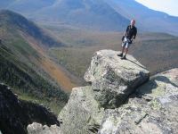
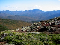
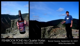
(September 30, 2007) The birth of the ADMIRALS. (Always a classy move.) PERU, MD & JB puttin' their footprints on the Bonds Range. Up at 4am (goodlord!) and hit the North Twin Trail at 8:30am. Got back to the car around 6:30pm, so around 10 hours. Geez, sounds easy enough now. About 20 miles and 10,000 feet of gain. We left Matt's car at Lincoln Woods and took Bob's to the North Twin trailhead. Gots to concur with many others that this is one of the real gems in the Whites. (And the Northeast.) This trek could getcha 5 major peaks - Guyot don't count! Gave me three, leaves me with one to clear the table: ISOLATION. (editors note: 4 years passed before Isolation was finally climbed.)
A fine mountain day, clear as a bell. Around halfway, we broke out some beer, a homebrewed Fishbrook Pond No Quarter Porter. A nice pick-me-up fer sure!
BONDS TRAVERSE: September 30, 2007

NORTH TWIN    4761'
SOUTH TWIN    4902'
GUYOT         4580'
WEST BOND     4540'
MT. BOND      4698'
BONDCLIFF     4265'

4.3 miles to NORTH TWIN via North Twin Trail
1.3 to SOUTH TWIN via N. Twin Spur
2.2 to GUYOT via Twinway
1.5 to WEST BOND via Bondcliff Trail
1.0 to MT. BOND
1.2 to BONDCLIFF

4.4 to Wilderness Trail
1.8 to Lincoln Woods Trail
2.9 to Lincoln Woods Visitor Center

Total miles 20.5
.:: 2010 BONDS TRAVERSE ::.

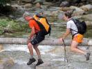
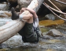
(June 26, 2010) One of the classics of the Whites, the mountaineers (Kate, Mike, Matty, Chrissie, Peru & I) hit trail shortly after 8am. UpsideDown Turtle assured us the water crossings would be routine. The first one we all de-booted and waded through. Soon after we had a pretty crankin' river with the choice of a coupla iffy felled trees and some ill-placed stones. The mountaineer formerly known as Matty D chose the large log, but finding it barkless and slick, got into a crouch and attempted to caterpillar his way across. Soon after all went south. He morphed into UpsideDown Turtle and needed a little help righting hisself. And assured us (shortly thereafter) slow and steady wins the race.
The water crossings early on slowed us a tad, but after a bit of steepitude you start reaping your reward with regularity. It's North Twin, South Twin, Guyot, West Bond, Bond & Bondciff. Out on the ridge is spectacular, and on this day the weather ebbed and flowed. Gray, misty and drizzly on and off, some wind but not severe. Not too socked in - views kept opening and closing. The kind of weather I really love in the mountains. Makes for interesting photos. Our only long stop was atop Bondcliff. A Fishbrook Quck Simcoe IPA and several PBRs washed down some tasty sandwiches, and a photo frenzy ensued. GhostGirl stopped and chatted, getting impatient with her friends who were capping off the Pemi Loop, evidently an 18 hour ordeal that dwarfs our little hike. GhostGirl: Hero. When the Frenchies finally caught us (again) we moved onward.
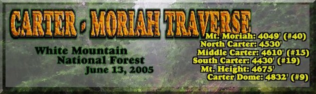
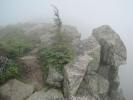
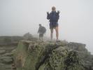
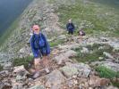
.:: 2005 CARTER - MORIAH TRAVERSE ::.
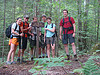
(June 13, 2005) The mountains were a callin', and we was a listenin'. There is nothing better to cleanse your soul than a long hike in the Whites. It is written. The late-great Matty D put forth a proposal for an ambitious undertaking (least fer a coupla lightweights): a traverse of the Carter Range, 17.4 miles, 6500' in gain, 13 hours according to the White Mountain Guide. All this after a 10-mile haul up Mt. Garfield (with expedition-mates Kate and Big Nude) the day before. Well, the boy's lost some gray matter over the years, an' I have too, so I says yeah. This will be the longest hike I've done in the Whites. MD's done longer, including a Bonds Traverse last year.
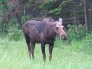
The Carter-Moriah Trail begins off Bangor Road in Gorham. Headed out before 9am. This trail is breathtaking. Just incredible. It is varied and sculpted. As Matt pointed out, it's no more than a foot wide for long stretches, affording natural visions of the surroundings. A misty morning, waves of weather whipping through the mountains. Spotted fresh moose tracks on the slopes of Mt. Moriah, and followed them for many miles. Matty said he ain't never met a moose he couldn't whup, so we wasn't ascared/i.
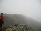
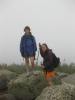
The trail ascends the insignificant Mt. Surprise (guidebook opinion), dips and rises to the summit of Mt. Moriah. A misty mountain with limited visibility, at least on this morning. As the day wore on the mist dissipated and some views began to open up. And by the end of the day we stood atop six major peaks in the Carter Moriah Range, four of which count as official peakbagger chedda! The unofficial Mt. Height afforded the finest views of the day.
.:: WASHINGTON: 6288' ::.
.:: 2011 MT. WASHINGTON: WHITE MOUNTAIN WEDDING ::.
June 25, 2011
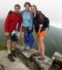
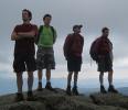
(June 25, 2011) On this fine foggy day, Chrissie & Bob got hitched atop Mt. Washington. Seven mountaineers (Chrissie, Bob, Kate, Mike, Tiffany, Reverend D, & JB) hit the trail at 7am. A great loop: Ammonoosuc Ravine Trail & Crawford Path, then the Westside Trail & Jewell Trail on descent.
Overcast day, seven knuckleheads (including Chrissie & Bob, who were soon to wed) pushed through the mist that was gathering on the shoulder of Mount Washington. Reverend D blessed our journey (with the power vested in him by the State of New Hampshire and the Church of the Dude) and we had a fine hike. Hiking on Mt. Washington is rugged. It's a huge sprawling mountain, 6288' last time I measured my feet.
Eventually we reached the pinnacle, and soon after kinfolk and friends were disembarking the Cog Railway. Everyone gathered in the Tip Top House and Reverend D commenced the service. "With the power vested in me by the State of New Hampshire and the Church of the Dude, whaddya gonna do?" They said, "Ya can't /ido nuttin' so we're gonna get hitched." And so it was. Very cool ceremony incidentally, with parents and siblings hauling stones, building a cairn. Unique. Best wedding I've ever been to.
I did a lot of filming of the hike, pre-hike, ceremony, celebration and descent. Unfortunately the ceremony footage is not available. If we can find it, the film will be complete. And available. For the low, low, superlow price of... FREE!
(February 5, 2012) The long anticipated film, "White Mountain Wedding", was finally completed, with a puppet show mimicking the unavailable ceremony footage. Premiered prior to the game on Superbowl Sunday, before the Giants once again defeated the Pats by a score of 21-17. Lotsa laughs, a few tears (mostly when the keg kicked at halftime.)
.:: 2008 GROUP 5 MT. WASHINGTON ROADRACE EXPEDITION ::.
June 21, 2008
(June 21, 2008) Gotta say, I really miss the mountains. No, I didn't run the Mount Washington Road Race. You sh!ttin' me?? Matty D did. I sh!t you not! On his 40th b 'day! Finished strong (1:19:24) in grand fashion (sans Bobby Peru's pink power-scully), good for #76 amongst the men. Then he hiked down the mountain with us. The Dude is legendary.
After checking in at the Intervale Motel on Friday night, the mountaineers (Kate, Mike, Sherry, Matt, Bob & I) met up at Moat Mountain Brewery for a strategy session. Beer. Pulled pork sandwich on raisin bread. After much brainstorming, we decided Matthew would tackle the run up the Auto Road whilst the rest of us hiked up Tuckerman and Lions Head. The meet-up would be on the summit. Good lord willin' and the creek don't rise.
Kate, Mike & Sherry hit trail around 6am, Bob & I around 7. Excellent hike - the mountains became cloudsplitters, and the mountaineers became thirsty. Me & Bobby McGee wuz plannin' a growler haul, but missed the window at Moat. So the hydration issue loomed over our ascent. Still a goodly bit of snow in the Tuckerman Ravine - we later saw a lone skier gettin' in his last licks.
Did I tell you how much I miss the mountains? We hit treeline, over the Lions Head, with clouds and mist slicing through the open view. A perfect day, not too windy at all as we approached summit shortly after 10am. The race had begun and a sizable crowd began to gather. A spandex-clad redhead... Met up with Sherry, Mike and Kate and staked out a spot maybe ten yards from the finish to watch and snap some pictures. None of us are generally thrilled by crowds on the mountaintop, but this was a really nice scene.
The winner (Eric Blake) glided over the final crest in 1:00:39, and the runners kinda looked either fresh or totally spent. So we worried a little bit about Matty. No worries. The Dude came charging up pumped and strong, looked like he was ready to do some REAL running! What a moment.
We hiked on down to Lions Head and had a Matty D B'Day Celebration. Kate and Big Nude once again did their magic producing a cake and a sixer of PBR talls. Surrounded by ridiculously high mountains and a cat with a medal. And Bobby Peru in his pink power-scully. Just sayin'. Had a legendary celebration at the Moat Mountain Smokehouse & Brewery, and several growlers were hiked onwards towards the Intervale. A front porch jam session capped off this fine day.
(June 22, 2008) ARETHUSA FALLS. A fine and popular waterfall. Our hike featured growlers and official Moat Mountain Smokehouse pint glasses. Gotta keep hydrated. Beautiful place, a nice short little (popular) hike.
June 26, 2005
(Sunday, June 26, 2005) Another successful ascent of the majestic slagheap they call Mt. Washington. The weather was perfect, quite a difference from a coupla years ago. Kate, Sherry, Mike & Matt hit the trail about 9am, I was an hour or so behind. Finally caught up near the summit of Monroe. Hardly any wind today, temperature maybe 70° - a nice respite from the heatwave below. Same loop as we did in 2003 - the Ammonoosuc Ravine Trail, Crawford Path, Westside Trail, and the scenic Jewell Trail.
June 2, 2003
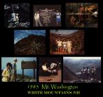
(Monday, June 2, 2003) The mountaineers were Bobby Peru, Matthew, & JB, and they took the Ammonoosuc Ravine Trail to the Lake of the Clouds Hut, then Crawford Path to the summit of Monroe (5384', #4) and on to the summit of Mt. Washington (6288, #1). It was 29° on the summit of Washington and the wind was whipping at 76mph. Seemed even more severe on Monroe. On descent it was the Westside Trail (crossing the Cog Railway tracks) to the incredible Jewell Trail. About 11 miles or so roundtrip.
I was woefully under-prepared on this one. MD loaned me his ancient brown ski cap, and my hands were pocketed (no gloves) in the howling wind. Peru offered the option of bailing on this one, but I felt it wasn't warranted. The wind was pretty brutal but we remained upright and stayed warm enough. Great day. The summit observation deck was a trip. All iced over, you would stand, into the wind, and slowly be moved backwards. Moondance without the effort.
October 1991
(October 1991) Marlene and I hiked up Tuckermans on a misty fall day.
October 20, 1990
(October 20, 1990) Icy and windy on the 1990 expedition on Mt. Washington. Dave, Moose & I persevered and summited the great mountain nonetheless. We ran the White Mountain Half Marathon the next day. Took the Tuckerman Ravine Trail, opted for the Lion Head Trail, then the Alpine Garden Trail and down the Huntington Ravine Trail. Moose's paws were bleeding, so Dave took her down on the Cog Railway.
October 1985: Tres Hombres de la Montańa...
(October 1985) On one perfect day in October, Jose, Spil & I were summoned to Mt. Washington. We called ourselves ' Tres Hombres de la Montańa'. I reckon we took the Tuckerman Ravine Trail up, the Alpine Garden Trail north and descended on the Huntington Ravine Trail. Remembering Spil cussing me for this plan. That dude will push uphill like nobody's business, but he don't like the downhill. Sunny and warm at the trailhead, cool and crisp above treeline. Jose was in New England for a year or so earning money for his kid's medical problems back in the Dominican. He coined the phrase and had a blast. Spil guided us until our feets was sore...
.:: ADAMS: 5774' ::.
September 21, 2008 King Ravine
(September 21, 2008) Mt. Adams (5774' #2) via King Ravine. One of the bestest treks in the East. Says I. This really is mountain climbing - the last step before the rope & piton stuff. Hand-over-foot for much of the trek, and in the boulderstrewn ravine, the 'trail' leads "Over, Under, Sideways, Down". (Cue in Yardbirds' 'Roger the Engineer'.)
Devo and I hit the trail at Appalachia around 10:30am. Nice day, somewhat overcast, comfortable. Set out on the Airline to the Short Line to King Ravine Trail, same loop as in 2005. Easin' through the woods for a coupla miles, then the King Ravine asserts itself. Stubborn as a Weasel. (No offense Danno.) King Ravine - muscling through boulders bigger than a breadbox, took the Subway option (why wouldn't you??) then a hefty hike up the rockslide to the headwall, and finally that familiar Presidential slagheap to the summit. Not too easy on the tootsies. The Subway, whilst not featuring high quality-low cal cuisine, p rese nts some i ncredible chbA HREF=/Ballenges, some narrow bellycrawls not recommended for folks who haven't followed the mantra of the Subway FatBoy Gone Thin. Yeah, this ain't no trail for pussies. When we plateaued at the junction of the Airline Trail, the whipping wind was, well, whipping. Threw on a hat and gloves for the summit push. Visibility really sucked - cairn to cairn was somewhat of a task. Socked in up high so no views. You realize how easy it can be to get lost up here.
We summited around 3pm or so. Very slow miles going up, an hour a mile as a guess. Hunkered down in a somewhat wind-shielded spot a few yards from the peak. Enjoyed a lunch of some fine Rhode Island subs Devo & Jen provided and a bottle of Stone Ruination IPA & some Talisker 18 scotch. Hiccup. A nice celebration. Some signs of the cloud cover breaking but it never did.
Twas Airline Trail for descent. Some views opened up from Airline on the way down. Not a heckuva lot in the way of visibility on this day, but it was still very cool. I love this misty surreal environment. Made for some good pictures as well. Got down at sundown, showered and retired to Moat Mountain Brewery for some grub & suds. A fine day. --JB
July 23, 2005 King Ravine
(July 23, 2005) Took the Airline Trail to the Short Line to King Ravine. Solo, bno oxygen. The Sherpas (Group 5) had the day off. Subway and Ice Caves, up King Ravine where it rejoins the Airline. On to Mount Adams, then descended the ridge on the Airline. Total of maybe 9 miles, but about the most strenuous climb I've done. Spectacular - woodsy slow ascent 'til you hit the King Ravine & Boulderville. Climb over, under, sideways, down & around this massive dump of granite, some the size of houses. Some as large as a Four Hands Tortollini Festival At this point, the recent hikes are at the top, followed by the biggies, mountains that have been visited many times, then chronologically, from 2004 onward. (When I started keeping better notes.) At this point, the recent hikes are at the top, followed by the biggies, mountains that have been visited many times, then chronologically, from 2004 onward. (When I started keeping better notes.) !
Subway seems to be the route of choice, belly-crawling through caves, finally reaching the scree leading up to the headwall. Elevated is the alternative. Hard going every step of the way. Decided to test my skills on the headwall, carefully picking a spot where I wouldn't tumble to an untimely demise. Got up about 10 feet (if that) and slipped down. A seasoned rock climber (or someone with crampons) could handle this. Few obvious handholds and it's steepness sent me skirting the groove between scree & wall. Although there are clear blazes, you can improvise much of this "trail", reading rock and finding the zone. I love this shit! Goes on my top ten list.
The ravine meets the plateau and the Airline Trail. And because it was there, I followed the slagheap on to the summit of Adams. Had me some lunch and an oilcan of Foster's Special Bitter. Thought about Mt. Jefferson, but the clouds were clashin' and the wind was whippin'. Impressive display - wish I had a video camera. After reviewing my options (and the weather), decided on the Airline for down. A beautiful trail that offered a bird's eye view of my earlier travels from the ridge above.
Thanks once again to the late-great Bobby Peru for indicatin' this one. He is rarely wrong, high-falutin', and toxic. A mountain man through & through. -- JB
August 24, 2003 Group 5 Madison - Adams Expedition
(August 24, 2003) The Group 5 Madison-Adams Expedition comprised Kate, Big Nude Mike, Matty & JB. From Appalachia we took the Airline Trail up the ridge, then the Gulfside Trail to Madison Hut. After summiting Madison (#5, 5367') and taking lunch, it was the Star Lake Trail (coincidently passing Star Lake) to the top of Adams (#2, 5774'). Raw & windy, you can never be overprepared for the Presidentials above treeline. (On this day we were disturbably short on beer.) Descended by the Valley Way.
.:: JEFFERSON: 5712' ::.
August 11, 2013
(August 11, 2013) Cue in the Beatles: "It was 30 years ago today, Jimmy Spil showed us all the way...." Sho' nuff, 30 years ago I hit the Caps Ridge Trail for the firs ttttttttt time.
Stepped out around 12:30pm today, which worked out perfect. Some weather passing through up there, and a coupla hours earlier it was socked in. The JB Magical Formula (start late when applicable!) does it again. Hadn't climbed the Caps Ridge in many years. It's only 2.6 each way, but talk about bang fer yer buck - lotsa hand-over-foot scamperin' and gain. I ventured out on some rockface pretending I was Messner or Hillary or someone. Another hiker commented, "You took the hard way. But there's no easy way."
Very cool hike on a perfect mountain day. Nice view of Washington when you get to the caps. The weather scrapes that mountaintop like no one's business. But it too had cleared by the time I was standing on the summit (of Jefferson). Adams, another favorite, looked massive and majestic today. Celebrated the summit with a bomber of Lonesome Shoe Spiky Shoe IPA and a Clif Bar.
August 19, 2005
(August 19, 2005) Matty D & I summited Jefferson on the 2005 Moonlight Presidential Traverse.
May 30, 2004
(Memorial Day Weekend, May 30, 2004) The Group 5 Mt. Jefferson Expedition took us to the summit (at 5712', the 3rd highest in the Whites) and beyond. The group of 5 was Chrissie, Bobby Peru, Big Nude, Matty D, & JB, all champin' at the bit. Nice day, in the high 40's, low 50's, sun beamin'. Another story above treeline though. The wind was a whippin' and we all bundled up. Took the Caps Ridge to the top, then ventured down the Gulfside Trail into Edmands Col - just incredible. A classic fer sure, looking towards Adams. As is traditional, an EQUINOX IPA was offered to the mountain gods, then swilled down mercilessly . . . And this just in: (just sayin') Reliable sources have reported the the Canadian Jay will eat Chocolate Pop-Tarts straight out of yer hand. Field research shows this to be inconclusive at best. But Chipper's another story...
Yet another fine day in the mountains. The wind and rocks were pretty brutal above treeline, and Jefferson, despite a relatively short ascent, is pretty wicked haahhd . . .
June 15, 2003
(June 15, 2003) This one was a quicky. Hit the Caps Ridge Trail at the crack of noon. (OK, maybe closer to 2pm.) Kinda overcast, and several caps upward the wind was whippin' and a storm was rolling in. So I hot-tailed it to the top, tagged the summit, took a coupla pictures, and bugged out. About a 5-mile stroll, maybe 2˝ hours roundtrip, but awful hard on the feets - thinking it's the pointy rocks. Maybe the wind as well. Takes some effort to keep your balance on this majestic slag heap.
July 1983
(July 1983) The weather started rollin' in as we got near the summit. Don't recall much else, 'cept we camped in a nearby National Forest campground and drank some beer afterwards. The summit party was Lou, Quarter, Spil & meself.
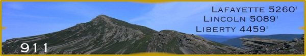
.:: LAFAYETTE 5260'. LINCOLN 5089'. ::.
.:: LITTLE HAYSTACK: 4780'. LIBERTY: 4459'. LINCOLN: 5089'. LAFAYETTE 5260'. ::. 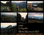
.:: 2015 Little Haystack, Lincoln, Lafayette. ::.
(September 27, 2015) The odds are even as my first three times on this range were socked in. The last three have been gorgeous, and on this day the mountain gods smiled. Truly one of the great hikes in the Whites, right alongside the Presidentials and the Bonds. Falling Waters Trail is a toughie, 3 miles and nowhere to go but up, but it's adorned with cascades and waterfalls, so no whining. When you get above the trees and summit Little Haystack everything opens up. You see your journey ahead in all its glory. And glorious it is.After camping at Tarry Ho Saturday night, hit the trail at 9:30am. Reached the car at 4:30pm so about 9 miles in 7 hours. Hoofed at at an average pace with 130 photo-ops and a half hour lunch break on a rock outcrop just below the summit of Lafayette. A bomber of Sierra Nevada Harvest Newly Developed Hops IPA was enjoyed alongside a Clif Bar. Many mountaineers shoed this loop today - a popular hike. As always, everyone was friendly (these are my people!) and respectful if you're moving faster than they. Also glad to see so many younguns. And nobody facebookin' - just taking photos I think. (Or maybe these mountains don't feature wi-fi.) Keepin' hope alive. One of my favoritest treks.
.:: 2011 Little Haystack, Lincoln, Lafayette. ::.
(June 18, 2011) Falling Waters, Franconia Ridge Trail, and the Greenleaf to the Old Bridle Path goin' down. Nice day with clouds rollin' in and out. Some blackfly action when the wind stilled. Had to cut out my lunch on their account. One of the great ridge hikes in the Whites.
.:: 2005 Little Haystack, Liberty, Lincoln, Lafayette. ::.
(September 11, 2005) Lost my original notes, but here is my story. Neither fact nor fiction I promise. My first good weather trip on this range - the CuRSE been BRoKEN. Indeed. A summit party of 5, featuring Jeannie, Matt, Big Nude, Kate & JB. Scampered up Falling Waters Trail, taking Liberty, and doubling back towards Lincoln and Lafayette. On Liberty we got an F-15 flyover, and large American flags festooned the peaks on this day. We raised a glass for our moms - Jeannie B who died on that day, and Matt & Kate's mom more recently. Matty & Jeannie headed down at that point to Truant's Tavern to catch the Sox. Big Nude, Kate & JB continued onward on the classic ridge. And never did I imagine how beautiful it was. Three times socked in with fog will do that to ya. Took a break on Lafayette to down some PBRs. On the hike down we were surprised by the energetic Matty D who had jogged halfway up the mountain after the Sox game. Lunatic. Awesome day on Franconia Ridge.
.:: 1988 Lafayette. ::.
(September 1988) Another raw day on Mt. Lafayette. Think I'm 0 for 3 on this mountain in terms of 'views from the top'. Took the Old Bridle Path to the Greenleaf Hut, and the Greenleaf Trail to the summit. Came down the same way. Roundtrip is about 8 miles. Cold and raw on top, I hunkered down, out of the wind. A snack and a beer then bugged out. A fine mountain despite its apparent disdain for me. -- JB
.:: 2004 ::.
.:: 2004 Moosilauke (4802') ::.
(White Mountains, April 18, 2004) The 2004 Moosilauke Expedition was a fine one. Mt. Moosilauke (4802') is the 10th highest in the Whites. The mountaineers (Tiffany, Skip, Matthew, JB), all climbing Moosilauke for the first time, took the Beaver Brook Trail (a part of the Appalachian Trail) out and back - about 7.6 miles alltold. (Incidently, my writing beverage is presently Tuckerman Pale Ale, bottle-conditioned, brewed in Conway, NH, and most excellent.)
Another early spring hike, perfect weather, cloudy in the 50's, still maybe 3-4 feet of snow on the trail, as there was on Eisenhower a coupla weeks back. The Beaver Brook Trail is a scenic one, but the first mile or so was pretty hairy. Icy and steep, we tried to avoid the tragic consequences of which we were duly forewarned. The trail is perched upon the endless Beaver Brook Cascades - one false step and it was CURTAINS!! CURTAINS I tell ya... certain death! But that certain curtain call would have to wait, as we hammered upwards, kicking steps into the ice. (Bringing up the rear I simply followed the stairway my colleagues broke for me, lazy bastid, but don't tell them that...) Some postholin' later, we broke treeline (and snowline) and hit summit.
Lunched atop Moosilauke with maybe a dozen hikers and several dogs, including a rambuncious retriever who damn near retrieved my sandwich. Tragic consequences indeed!
The mountain gods must like us or something, because the hike down was SLAMMIN'. Bootskiin' down on much of the trail, as the sun had softened the icy path. Matty and Tiff were hammerin' down, Skip and I followed in their wake. What a blast. Dessert after a fine meal - slidin' boot down the mountainside. (I done done it once out west years ago, but it's still a new experience.) We won't pass up hiking this time of year again... Anyhoo, after a quick head count at the bottom of the mountain, casualties were under 50%. Collateral damage: we ain't sayin'... -- JB
.:: Mount Hale (4054')::.
(August 28, 2004) Solo ascent, no oxygen. The Comeback Kid, or so I hopes. Mt. Hale (4054' #38 of 48) is a nice short one, 4.6 roundtrip. Let myself go to hell this summer, so when all was said and done, I was an embarrassment. Hurtin' for a coupla days. The hike's out of Zealand Valley, and kinda typical for the Whites. At the summit I was assaulted by black flies, first time this year. Bastids. Looked like a fire tower used to be here - the view is otherwise obscured by foliage.
.:: North Twin (4761') & South Twin (4902') ::.
(September 4, 2004) Solo ascent, no oxygen. North Twin (4761' #12) & South Twin (4902' #8) were bagged and tagged. When I mentioned to someone I was doing the Twins this weekend, they asked about the Bush twins... Well, no such luck, least 'til their daddy gives us our country back.
The trailhead was found (with Bobby Peru's spiritual guidance) on an unmarked dirt road off Rt. 3. Just before the Presidential View Cabins, my new favorite place if you forget your tent. Hit the North Twin Trail around 10am, in the mist, smooth and easy for a coupla miles, then up the mountainside. The trail approaching North Twin and connecting to South Twin is a classic. A beautifully sculpted trail not unlike those in the Great Range of the Adirondacks. Several parties I met (who had started their hike earlier) reported cloud cover on the summit. I lucked out. There's a nice outcrop on the shoulder before the summit of North Twin. But South Twin is the beauty. Hung and explored for about an hour, suckling an oilcan of Foster's Special Bitter, and checking out the trails towards Bondcliff and Galehead. Came close to doing Mt. Guyot but (wisely!) chose not to. It was 5:30 when I returned to the trailhead - about 11-12 miles alltold - getting my mountain legs back, I think... -- JB
.:: 2005 ::.
/\
.::/51\::.
.:: 2005: 51 PEAKS!::.
(June 1, 2006) Started the official list in 2002, though I'd been hiking in the Whites (at least occasionally) for much of my adult life. And kept some notes, mostly when it was fresh in my memory, some written on the blank pages they leave you in guidebooks. In recent years on the computer. But much was lost when the old computer died.
Stood atop 51 peaks last year - ahh, the joys of having no life! Overall I gots 38 in the Whites, 20 in the 'Dacks, and a batch in Baxter State Park. Living the moment. And counting. Comin' on fast are Big Nude, who's at 28, Kate's bagged 22, Matt at 36, and Chrissie atop 33 (2011 editor's note: 46 now. 2012 editor's next note: she done got all 48! HooRah Xrici!). There's a possibility we could all save the last one to climb together. (2011 editor's note: didn't happen although most of my friends here climbed Isolation with me, my 48th peak.)
/\
.::/??\::.
CANNON (4100')
(April 17, 2005) Took the Kinsman Ridge Trail up Cannon, ski destination and home of the Old Man. Or resting place I should say... miss that guy... the blazes were sparse on the snow-covered trail, so I mostly bushwhacked. Nice day, around 40°-50°, and great views of Lafayette and Lincoln, Franconia Notch, and a peak at Washington as well. Boot-skiied down the ski trails on descent. About 4.4 miles alltold.
The first coupla shots were taken late-October 2002, shortly before the Old Man plummeted to his death. RIP.
/\
.::/??\::.
OSCEOLA (4340') & EAST OSCEOLA (4156') 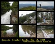
(May 14, 2005) On a pleasant overcast day in May, Matty and JB bagged a coupla beautacious peaks in the Sandwich Range. Another classic trail, not long in distance, but some serious elevation gain and great rock scampers. Took the Greeley Pond Trail (from the north off the Kanc) to the Mt. Osceola Trail. East Osceola (#33, 4156') has a wooded peak but some nice views on the way. Some serious steepitude on the col between, then onto Mt. Osceola (#23, 4340').
Osceola, named after the Seminole chief, is the highest of the Sandwiches - unless, of course yer talkin' about Mamma Maz's Monster Meatball Sandwich. The Chimney, a short steep funnel of loose rock separates the men from the boys. The manly-men then celebrated the summit with a Smuttynose IPA and a sandwich. Watched a storm roll in on Mt. Washington. On the retreat we hoofed over to Greeley Pond. Pretty pond. Scouted out some nice tentsites.
.:: 2005 CARTER - MORIAH TRAVERSE ::.
(June 13, 2005) The mountains were a callin', and we was a listenin'. There is nothing better to cleanse your soul than a long hike in the Whites. It is written. The late-great Matty D put forth a proposal for an ambitious undertaking (least fer a coupla lightweights): a traverse of the Carter Range, 17.4 miles, 6500' in gain, 13 hours according to the White Mountain Guide. All this after a 10-mile haul up Mt. Garfield (with expedition-mates Kate and Big Nude) the day before. Well, the boy's lost some gray matter over the years, an' I have too, so I says yeah. This will be the longest hike I've done in the Whites. MD's done longer, including a Bonds Traverse last year.
The Carter-Moriah Trail begins off Bangor Road in Gorham. Headed out before 9am. This trail is breathtaking. Just incredible. It is varied and sculpted. As Matt pointed out, it's no more than a foot wide for long stretches, affording natural visions of the surroundings. A misty morning, waves of weather whipping through the mountains. Spotted fresh moose tracks on the slopes of Mt. Moriah, and followed them for many miles. Matty said he ain't never met a moose he couldn't whup, so we wasn't ascared/i.
The trail ascends the insignificant Mt. Surprise (guidebook opinion), dips and rises to the summit of Mt. Moriah. A misty mountain with limited visibility, at least on this morning. As the day wore on the mist dissipated and some views began to open up. And by the end of the day we stood atop six major peaks in the Carter Moriah Range, four of which count as official peakbagger chedda! The unofficial Mt. Height afforded the finest views of the day.
/\
.::/24-25\::.
.:: N. Tripyramid 4140' Middle Peak 4110' South Peak 4100' ::.
(July 3, 2005) Kate, Sherry, Danielle, Big Nude, Matt and I comprised the Independence Expedition Team on the 3rd of July. Zig-zagging through Elephant Rock Trail & some broad logging trails around 10am, we found our bad selves on the Livermore Tr align=ail, the flat woodsy path to the base of North Tripyramid. Twas the Livermore, North Slide, South Slide, to the Tripyramid. Then an exhilarating climb up North Slide: 1200 feet of gain in one ˝ mile segment. Views to die for. Epic! This has become one of my favorite mountains - after the first few woodsy miles lull you into a sense of security the serious stuff presents itself. Not just another walk in the wood.
This is a real mountain trail, with hand-over-foot climbing much of the way. None of us had been here before so no one knew what to expect. Turned out Danielle bit off a bit more than she could chew, and her fear of heights put her into a panic. This was a difficult element for most of us, as we were lovin' the heck out of this experience. The DeMarrais' saved the day once again. Kate coaxed Danielle up to the main summit. Not an easy task. Whilst we took lunch, Matty D jogged to Middle Peak and tagged it (shameless peakbagger he.) He and Sherry escorted Danielle down the mountain via the less severe Scaur Ridge Trail. Kate, Big Nude & I continued onwards, completing the loop over Middle Peak (4110') and South Peak (4100'). Celebrated with Pabst Blue Ribbon & Victory Prima Pils. And a slow descent down South Peak. -- JB
/\
.::/ADAMS\::.
.:: 2005 King Ravine - Mount Adams ::.
(July 23, 2005) Took the Airline Trail to the Short Line to King Ravine. Solo, no oxygen. And the Sherpas (Group 5) had the day off. Subway and Ice Caves, up King Ravine where it rejoins the Airline. On to Mount Adams, then descended the ridge on the Airline. Total of maybe 9 miles, but about the most strenuous climb I've done. Spectacular - woodsy slow ascent 'til you hit the King Ravine & Boulderville.Climb over, under, sideways, down & around this massive dump of granite, some the size of houses. Some as large as a Four Hands Tortollini Festival!
Subway seems to bBe the route of choice, belly-crawling through caves, finally reaching the scree leading up to the headwall. Elevated is the alternative. Hard going every step of the way. Decided to test my skills on the headwall, carefully picking a spot where I wouldn't tumble to an untimely demise. Got up about 10 feet (if that) and slipped down. A seasoned rock climber (or someone with crampons) could handle this. Few obvious handholds and it's steepness sent me skirting the groove between scree & wall. Although there are clear blazes, you can improvise much of this "trail", reading rock and finding the zone. I love this shit! Goes on my top ten list.
The ravine meets the plateau and the Airline Trail. And because it was there, I followed the slagheap on to the summit of Adams. Had me some lunch and an oilcan of Foster's Special Bitter. Thought about Mt. Jefferson, but the clouds were clashin' and the wind was whippin'. Impressive display - wish I had a video camera. After reviewing my options (and the weather), decided on the Airline for down. A beautiful trail that offered a bird's eye view of my earlier travels from the ridge above.
Thanks once again to the late-great Bobby Peru for indicatin' this one. He is rarely wrong, high-falutin', and toxic. A mountain man through & through. --JB
                           /\
                      /\  //\\owl's head 4025'
               /\    //\\///\\\        /\
              //\\  ///\////\\\\  /\  //\\
 /\          /  ^ \/^ ^/^  ^  ^ \/^ \/  ^ \
/ ^\    /\  / ^   /  ^/ ^ ^ ^   ^\ ^/  ^^  \
.:: OWL'S HEAD: 4025' ::.
(July 31, 2005) Another hefty hike with a little twist to make it innerestin'. A Matty D good-idear of course. Owl's Head (4025') was conquered via some standard trails and an old-f. Over, Under, Sideways, Downashioned backwoods bushwhack. Took the
Lincoln Woods Trail to Black Pond (via the Black Pond Trail) and bushwhacked north to the Lincoln Brook Trail, then on and up Owl's Head Path. Tracking moose much of the way. Mucho moose evidence. No moose. Great views of Liberty, Lincoln, Lafayette (Franconia Range) from the slide, up on Owl's Head. An unmaintained herdpath takes you to the wooded summit. Matthew, desperate for a view, done climbed a big tree. To no avail. A Fosters Bitter was shared upon the the sorta-summit. A fine day in the mountains: Owl's Head's got a bum rap in my opinion. It's a beautiful mountain perched between Franconia and the Bonds. Lotsa wildlife, because of it's isolation and because it's less traveled. Matt got a great shot of a healthy lookin' garter snake high on Owl's Head Path. Goin' down we backtracked across Franconia Brook to the Franconia Brook Trail, and onto the Wilderness Trail. About 18-19 miles by my calculation. Foots was tired. -- JB
.:: 2005 MOONLIGHT MIDNIGHT PRESIDENTIAL TRAVERSE ::.
(August 19, 2005) Under a full moon... A Moonlight Presidential Traverse in the Whites - the whole enchalada. An hellacious undertaking! A seed was planted when we read of hiking under a full moon and watching sunrise . (Cue in Yardbirds' 'Roger the Engineer'.) Shortly after midnight mountaineers Matty D & JB departed Appalachia. Crisp in the 40's, we followed the Valley Way Trail, climbing Madison & Adams in the dark. Using flashlights until we neared treeline. (The stylin' yet practical Matty D used a headlamp.)
Reached the summit of Adams in time for sunrise, a mahvelous sight. Then, after a much needed JB snore on a high meadow, we were collected by the amiable John from Philly who had hit trail about 2am. He joined us on and off for the rest of the endeavor. It was onto Jefferson, Clay, Washington, Monroe, Franklin, Eisenhower & Pierce. On the summit of Mt. Pierce, a small celebration ensued. The traditional oilcan of Foster's Special Bitter was tapped, and sandwiches were shared with the rambunctious Gray Canadian Jays. (Dap to Philly John who continued on over Jackson & Webster.) Almost 18 hours later we stumbled into Crawford Notch. Geez, sounds easy enough now. About 20 miles and 10,000 feet of gain.
(September 1, 2005, 10:44pm) Two weeks ago, as fate would have it, Matt & myself were finishing off a Tuckerman Pale Ale at Truant's Tavern in Lincoln and heading north towards trailhead. Had many concerns at this point in time. Matty D was, as always, in tip-top shape. My mountain legs were as good as they've been in a long while - we traversed the Moriah-Carter Range a month earlier, and trekked some serious miles this season. 11 mountain trips this year for me before this one. My main concern was skipping a sleep cycle. And it kicked my sorry butt early on. By the time we reached Thunderstorm Junction on the southern slope of Adams, I was sleepwalking. My legs were jelly. Matty D was sayin, "Don't be a pussy, you f*ckin' pussy!!" Not really, but I seriously wasn't gonna make it without some shuteye. After a snooze I wuz done reborned. Felt pretty doggone strong fer the rest of the haul.
When we reached Mt. Washington, we fueled up with a sitdown meal of chili & pizza. And Coke for me - I suddenly remembered my caffeine addiction! The mobscene didn't faze us on this day. Although it did stop us from tagging the actual summit. (This technicality makes the traverse officially unofficial. 18 hours wasted.) From this point on we encounter/ied many hikers & hut-folks. BAn epic hike - just incredible. Miserable as I felt early on, after sunrise and a nap I loved every minute of it. Almost... -B- JB
Trail                  Destination                  Miles   Guidetime

VALLEY WAY             to MADISON HUT                 3.8      3:40
OSGOOD TRAIL           to MADISON SUMMIT              4.3      4:10
                  back to MADISON HUT                 4.8      4:40
STAR LAKE TRAIL        to ADAMS                       5.8      5:40
LOWES PATH             to GULFSIDE                    6.1      6:00
GULFSIDE             from THUNDERSTORM JCT.
                       to JEFFERSON LOOP              7.6      6:55
                       to JEFFERSON SUMMIT            8.0      7:25
                  down to GULFSIDE TRAIL              8.4      7:55
GULFSIDE (the Cornice) to MT. CLAY LOOP              10.1      9:00
                       to WASHINGTON SUMMIT          11.2     10:00
CRAWFORD PATH          to LAKES of the CLOUDS HUT    12.7     11:25
                       to MT. MONROE LOOP            13.4     11:55
                       to EISENHOWER LOOP south      15.4     13:15
                       to MT. PIERCE SUMMIT          16.8
                       to SACO LAKE (Crawford Notch) 20.1     17:40
.:: LITTLE HAYSTACK: 4780'. LIBERTY: 4459'. LINCOLN: 5089'. LAFAYETTE 5260'. ::.
.:: 2015 Little Haystack, Lincoln, Lafayette. ::.
(September 27, 2015) The odds are even as my first three times on this range were socked in. The last three have been gorgeous, and on this day the mountain gods smiled. Truly one of the great hikes in the Whites, right alongside the Presidentials and the Bonds. Falling Waters Trail is a toughie, 3 miles and nowhere to go but up, but it's adorned with cascades and waterfalls, so no whining. When you get above the trees and summit Little Haystack everything opens up. You see your journey ahead in all its glory. And glorious it is.After camping at Tarry Ho Saturday night, hit the trail at 9:30am. Reached the car at 4:30pm so about 9 miles in 7 hours. Hoofed at at an average pace with 130 photo-ops and a half hour lunch break on a rock outcrop just below the summit of Lafayette. A bomber of Sierra Nevada Harvest Newly Developed Hops IPA was enjoyed alongside a Clif Bar. Many mountaineers shoed this loop today - a popular hike. As always, everyone was friendly (these are my people!) and respectful if you're moving faster than they. Also glad to see so many younguns. And nobody facebookin' - just taking photos I think. (Or maybe these mountains don't feature wi-fi.) Keepin' hope alive. One of my favoritest treks.
.:: 2011 Little Haystack, Lincoln, Lafayette. ::.
(June 18, 2011) Falling Waters, Franconia Ridge Trail, and the Greenleaf to the Old Bridle Path goin' down. Nice day with clouds rollin' in and out. Some blackfly action when the wind stilled. Had to cut out my lunch on their account. One of the great ridge hikes in the Whites.
.:: 2005 Little Haystack, Liberty, Lincoln, Lafayette. ::.
(September 11, 2005) Lost my original notes, but here is my story. Neither fact nor fiction I promise. My first good weather trip on this range - the CuRSE been BRoKEN. Indeed. A summit party of 5, featuring Jeannie, Matt, Big Nude, Kate & JB.
.:: 1988 Lafayette. ::.
(September 1988) Another raw day on Mt. Lafayette. Think I'm 0 for 3 on this mountain in terms of 'views from the top'. Took the Old Bridle Path to the Greenleaf Hut, and the Greenleaf Trail to the summit. Came down the same way. Roundtrip is about 8 miles. Cold and raw on top, I hunkered down, out of the wind. A snack and a beer then bugged out. A fine mountain despite its apparent disdain for me. -- JB
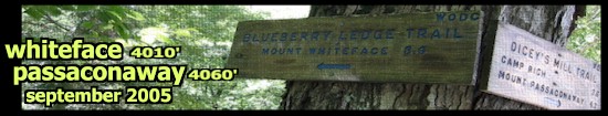
.:: WHITEFACE: 4010'& PASSACONAWAY: 4060' ::.
(September 24, 2005) Trails: Blueberry Ledge, Rollins, Walden, Old Mast. About 12.5 miles roundtrip. Another great loop, dap to Bobby Peru once again. Some nice cliff-scamperin' on Whiteface. On the (sort-of) summit I shot the sh!t with several shameless peakbaggers. For one chick, this was #47. With only Owl Head remaining. For her. Me - I gots a lotta climbing left.
Pretty cool was the plaque on the (sort-of) summit of Whiteface. Louis Tainter is remembered, "his ashes repose herein" the iron tablet reads. Here's to you, Louis, and here's to the hope none of that stuff blew into my beer or on my sandwich. Just sayin'...
.:: 2006 ::.
.:: CHOCORUA: 3500' ::.
(March 19, 2006) On the last day of winter, on a mountain not far from here, a handful of folks battled the ice in an attempt to summit Mt. Chocorua. Some wore crampons, some bare-booted, and a group of Germans wore sneakers. The crampon folks made it to the top. The others didn't. Dap to Bobby Peru and Chrissie, who barebooted to the summit a coupla weeks ago. Meself, I wore a stabilicer on me left foot.Great day, about 16° at trailhead and very icy in spots. Heated up quickly though, and I did the hike below treeline in long-undies and pantaloons. And a stabilicer. Watched some ice climbers on Pitcher Falls for a bit. Hiked up and around, checking out Champney Falls, then bushwhacked back to the Champney Loop Trail. Sheet of ice on the steps made it impassable for me so I doubled back to the main trail, then headed for the top.
A real nice trek, passing the trail to Middle Sister, a future sidetrip. The summit is a sprawling exposed mass of granite, and raw on this day. Excellent place to take pictures and climb rock. And have a homebrew. Which (SURPRISE!!) I did in a shielded area just under the summit. Fat Tuesday Ale never tasted better. Fell on my ass and slid about 20 feet shortly afterwards. Coincidence? Crampons would've been the right call in these conditions.
Some weather happenin' all around, especially north towards the Presidentials and west towards Tripyramids. A few flurries here, but no complaints. -- JB
/\
.::/34\::.
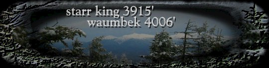
.:: STARR KING: 3915'& WAUMBACK: 4006' ::.
(April 8, 2006) A coupla nice mountains way up north: Starr King and Waumbek afforded a fine winter experience, despite this being April. A slightly overcast day, about 20° at trailhead, 7.2 miles ro.Climb over, under, sideways, down img color= src=undtrip with 2600' gain. The Starr King Trail was a bit sloppy at the outset, but much of this trail carves through a beautiful evergreen (spruce?) forest. Snow covered, but fine for barebootin'. Observed some moose tracks, maybe a day old on the trail.
A Fishbrook Pond Fat Tuesday Ale was enjoyed on the summit of Waumbek, and evidence was burned on the Witch's Other Chimney atop Starr King.
/\
.::/35\::.
FLUME (4328') (April 29, 2006) Couldn't pass up another prefecto day in the mountains. And crossed one (#35) off the list to boot. (A bakers' dozen left before I can retire to the couch.) Climbed Mt. Flume (4328') from the south, via Lincoln Woods Trail and the Osseo Trail. Great views of the Bonds and Franconia. And a snow-blanketed Mt. Washington. Around 60° at trailhead, maybe dipped into the 50's on top. Tough circumstances fer sure, but we mountaineers persevere...
Only a few hearty souls on the Osseo Trail today, the drummer Java Joe and his fine lady were headin' towards Liberty. They barebooted the Flume Slide Trail, no easy task in these conditions. Dap. The Osseo is a bit longer and mellower, about 11.2 roundtrip. (Banged up my knee the other day, so this was a good choice.) Clear hike until the ladders, then snow and ice for the duration. Maybe 2 feet packed, judging by the postholes.
Spent a half hour or so on the summit, enjoying one of the last Fat Tuesday Ales on a crystal clear afternoon. Took some pics. Donned my trusty stabilicers for descent. These suckas are a godsend. If the Baby Jesus had these, he wouldn't a hadta part the Red Sea (Johnny 4:20). Yeah, I'm going straight to hell. But hopin' Big Eddy let's me stand atop another mountain or two before I go. -- JB
/\
.::/36\::.
(May 7, 2006) Mt. Carrigain (4700') lies smack in the middle of the Whites, high and isolated, and the two-story observation tower on the summit affords 360° of Northeastern wilderness. From Sawyer River Road, took the Signal Ridge Trail over a coupla high-water crossings and slowly upwards towards, yep, SIGNAL RIDGE! The trail to that point seemed somewhat nondescript, much of it straight and slow in gain, snow and ice as you reach higher elevation. But out of the trees the ridge opens to some spectacular viewage.
CARRIGAIN (4700') Lost the trail shortly after re-entering the forest, maybe a quarter-mile from the summit. Bushwhacked through some thick shrub and scrub, a-scraping and a-clawing, post-holing and cussin'. But emerged on the high ground and up the 2-story tower, where I had a coupla Guinness Drafts and took a bunch of pictures. 10 miles roundtrip, 3250' gain, and #36 for me, but who's counting? -- JB
/\
.::/37-38\::.
(May 28, 2006) We (Big Nude, Kate, & meself) hit the Lonesome Lake Trail about 10am, around the beautiful Lonesome Lake to the Fishin' Jimmy Trail. The Kinsman Ridge Trail took us over the summits of North Kinsman and South Kinsman. On descent it was the Kinsman Pond Trail, the Cascade Brook Trail loopin' back to the Lonesome Lake Trail. Matty D supplied the re-con from a coupla weeks prior. He done summited Cannon as well.
SOUTH KINSMAN (4358') - NORTH KINSMAN (4293') Views of Franconia's biguns across the way were present throughout, and tales of trillium were told. These are beautiful and varied trails, some rough and rocky, some smooth and woodsy. About 12 miles all-told, pretty tough miles in my opinion. A PBR celebrated the (almost) summit of North Kinsman and a Tod Mott Saison was imbibed on Kinsman Pond. The view of Kinsman Pond from the lower outcrop was just gorgeous.
If it wasn't for bad luck, I wouldn't have no luck at all... This brought home some memories of an ill-fated backpacking trip we did maybe 25 years ago. In early June we hiked from the south on the Gordon Pond Trail to the Kinsman Ridge Trail. Torrential downpour, black flies, the elements were agin us every step of the way. And the Boy Scouts.... Don't get me goin'... Some longass days on this backpacking folly. But some well-earned miles. These are not easy trails, rocky and water-laden even in normal circumstances. Muchos gainos as well. And goin' with a full pack... So I'm givin' us some serious dap - we covered some HELLacious miles in crappy conditions. Didn't really enjoy it 'til we were drinkin' beer in a cottage the evening we got down.
/\
.::/39\::.
WILDCAT "E" (4041') (June 18, 2006) Into the teeth of the beasties... Rarely do I have a bad day in the mountains, but it's blackfly season. Those little suckers can really make you miserable. Chase you off the damn mountain, matter of fact. Took the the Lost Pond Trail, about a flat mile to Lost Pond (now known as 'Found Pond'), then some serious up on the Wildcat Ridge Trail. The blackflies were just annoying for the first few miles, but once I got out in the open on the summit, the bastids swarmed me. Pushed onward into the woods where it was a bit better.
Met 3 souls on the ridge, two were bitten and beaten old folks like meself, one was a beautiful 20-something that looked like she stepped out of the shower. She was 20 minutes ahead of her party, and disappointed that they were opting to descend by the ski lift. Expressed my disdain for that option. An hour later, after summiting Wildcat (or so I thought!), as I turned to retrace my steps, bitten and beaten, I welcomed that option. But by the time I got back to Wildcat E, the ski lift was no longer running. But the buggies were doin' dinner.... and I was the main course.
At that point I made a bad choice. Rather than retrace my route down the mountain on the Wildcat Ridge Trail, in a panic I ran down the ski slope. High grass, iffy terrain. Slappin' bugs off my head and legs the whole way. WAM! WHOP! BOP! BAM! Two miles later, 222 bites later I reached the lonesome highway. What a godawful day. BLACKFLY: NEW HAMPSHIRE STATE BIRD. These little muthas get into your ears, anyplace that isn't covered. Hate 'em. June in the Whites: Not so much.
And I never made it to the main Wildcat summit. (Thought I might have, but after an official review by Bobby Peru, it was apparent that I did not.)
/\
.::/40\::.
GALEHEAD (4024') (July 31, 2006) .::/40\::. Galehead was scaled yesterday, giving yours truly the BIG 4-0. 40 peaks. I'm gonna have to get the updated info on my colleagues, but this is a milestone. Nice hike, woodsy throughout, then rising briskly towards Galehead Hut, and a half-mile to the summit. About 10 miles roundtrip. Some blackfly swarmin' at the summit in late afternoon, but not too bad. A Fishbrook Pale Ale was enjoyed on top.
/\
.::/41\::.
NORTH HANCOCK (August 13, 2006) .::/41\::. It was North Hancock (4403') via the Hancock Notch Trail, Cedar Brook Trail to the Hancock Loop. Roundtrip 8.6 miles. Don't know why I didn't enjoy this trail in 2002 - it really is quite nice. Many stream crossings (of Cedar Brook) and a slowly sloping woodsy hike. Your gain happens on the last half mile or so. Spectacular southern view of the Sandwiches (Osceola, Tripyramids) from an outlook near the summit. An' a homebrew on top!
.:: Mt. Pierce: 4310" ::.
(August 26, 2006) Quarter returns to the White Mountains, and they'll never be the same! At high-noon (2:30pm) we hoofed it up Mt. Pierce (a.k.a. Clinton, 4310') on the late-great Crawford Path. Bootiful day, nice view north towards the Presidentials, where a storm seem to be settling in on Washington. Now there's a surprise. Nice contrast though, as the sun was shining on Pierce.
One of the finest scenes in the Whites, in my opinion, is when you're nearing the summit, hit treeline on the ridge and the views open up. A direct line north to the Presidentials. Always spectacular. An' Jeff can cross another one off his list. (Poor sap doesn't even know he has a list yet.) A 6.6 mile loop. A homebrew atop. And a few at the Woodstock Brewery after.
/\
.::/42\::.
ZEALAND (September 2, 2006) .::/42\::. On a pleasant overcast day, the top of Zealand Mountain (4260') was visited and toasted with a bottle of Fishbrook Pale Ale. Kind of a spur of the moment hike, as I abandoned the planned Erebus Summer Trip on account of weather. There was quite a crowd today on the Zealand Trail to the Zealand Falls Hut. Labor Day weekend and a hut trail will bring 'em out.
Nice and flat through some pretty wetlands, some the result of beaver dams. Made some quick time to the hut, about 2.8 miles in. Then onto the Twinway, where the climb really begins. Some great outlooks near the summit. 11.2 miles total.
/\
.::/43\::.
.:: CABOT BACKPACKING TRIP: 4170' ::.
(Ocktober 15, 2006) .::/43\::. Sherry, Matt & I backpacked up to Unknown Pond, in the northernmost sector of the White Mountains. In the dead of night. And a rugged trail it was. Flat and muddy for a short, then a steady clinb over roots & rock for the duration. With full packs. Just sayin'. Camped at about 3000', then hit trail mid-morning for Mt. Cabot (4170'.) The Horn has the views, but Cabot had the brews! A Fishbrook Pond Oktoberfest for me and a Long Trail Ale fer Matty D. It was #43 for JB and #39 for Matthew, so a quick celebration ensued as the winds kicked up. Sherry's not even counting. Must be a chick thing.
Some flurries, ice & snow along the trail slowed the pace a bit. But generally spectacular - pretty remote up here. Saw only a man and his dog in two days.
/\
.::/44\::.
WILDCAT (October 22, 2006) Took the 19 Mile Brook Trail through Carter Notch to the Wildcat Ridge Trail and back. 8.6 miles. A nice trek this was, quite different from my first attempt on this ski mountain. (See June 2006.) Some beginning of winter conditions in the Whites, some snow and ice, but really just a comfortable day in the mountains. Some great views of the slide on Carter Dome. A Bear Republic Hop Rod Rye was imbibed upon summit, and a homebrewed Fishbrook Pond Oktoberfest on the way down.
Some of the nicest pictures were of a raging snowstorm in the Sandwich Range. (On the drive home after dinner at Moat Mountain.)
.:: 2007 ::.
/\
.::/45,46,47\::.
.:: 2007 BONDS TRAVERSE ::.

(September 30, 2007) Up at 4am (goodlord!) and hit the North Twin Trail at 8:30am. Got back to the car at 6:30pm, so around 10 hours for . Geez, sounds easy enough now. About 20 miles and 10,000 feet of gain. We left Matt's car at Lincoln Woods and took Bob's to the North Twin trailhead. Gots to concur with many others that this is one of the real gems in the Whites. (And in the Northeast!) This trek could getcha 5 major peaks - Guyot don't count! Gave me three, leaves me with one to clear the table: ISOLATION.
BONDS TRAVERSE: September 30, 2007

NORTH TWIN  4761'
SOUTH TWIN  4B902'
GUYOT       4580'
WEST BOND   4540'
MT. BOND    4698'
BONDCLIFF   4265'

4.3 miles to NORTH TWIN via North Twin Trail
1.3 to SOUTH TWIN via N. Twin Spur
2.2 to GUYOT via Twinway
1.5 to WEST BOND via Bondcliff Trail
1.0 to MT. BOND
1.2 to BONDCLIFF

4.4 to Wilderness Trail
1.8 to LBincoln Woods Trail
2.9 to Lincoln Woods Visitor Center

Total miles 20.5
.:: 2008 ::.

/I .:: 2008 GROUP 5 MT. WASHINGTON ROAD RACE EXPEDITION ::.
(June 21, 2008) Gotta say, I really miss the mountains. No, I didn't run the Mount Washington Road Race. You sh!ttin' me?? Ma tty D did. I sh!t you not! O/iBn his 40th b'day! Finished strong (1:19:24) in grand fashion (sans Bobby Peru's pink power-scully), good for #76 amongst the men. Then he hiked down the mountain with us. The Dude is legendary.
After checking in at the Intervale Crack Motel on Friday night, the mountaineers (Kate, Mike, Sherry, Matt, Bob & I) met up at Moat Mountain Brewery for a strategy session. Beer. Pulled pork sandwich on raisin bread. After much brainstorming, we decided Matthew would tackle the run up the Auto Road whilst the rest of us hiked up Tuckerman and Lions Head. The meet-up would be on the summit. Good lord willin' and the creek don't rise.
Kate, Mike & Sherry hit trail around 6am, Bob & I around 7. Excellent hike - the mountains became cloudsplitters, and the mountaineers became thirsty. Me & Bobby McGee wuz plannin' a growler haul, but missed the window at Moat. So the hydration issue loomed over our ascent. Still a goodly bit of snow in the Tuckerman Ravine - we later saw a lone skier gettin' in his last licks.
Did I tell you how much I miss the mountains? We hit treeline, over the Lions Head, with clouds and mist slicing through the open view. A perfect day, not too windy at all as we approached summit shortly after 10am. The race had begun and a sizable crowd began to gather. A spandex-clad redhead... Met up with Sherry, Mike and Kate and staked out a spot maybe ten yards from the finish to watch and snap some pictures. None of us are generally thrilled by crowds on the mountaintop, but this was a really nice scene.
The winner (Eric Blake) glided over the final crest in 1:00:39, and the runners kinda looked either fresh or totally spent. So we worried a little bit about Matty. No worries. The Dude came charging up pumped and strong, looked like he was ready to do some REAL running! What a moment.
We hiked on down to Lions Head and had a Matty D B'Day Celebration. Kate and Big Nude once again did their magic producing a cake and a sixer of PBR talls. Surrounded by ridiculously high mountains and a cat with a medal. And Bobby Peru in his pink power-scully. Just sayin'.
(June 22, 2008) ARETHUSA FALLS. A fine and popular waterfall. Our hike featured growlers and official Moat Mountain Smokehouse pint glasses. Gotta keep hydrated.
.:: 2008 KING RAVINE - ADAMS ::.
.:: ::.
(September 21, 2008) Mt. Adams (5774' #2) via King Ravine. One of the bestest treks in the East. Says I. This really is mountain climbing - the last step before the rope & piton stuff. Hand-over-foot for much of the trek, and in the boulderstrewn ravine, the 'trail' leads "Over, Unde, then descended the ridge on the r, Sideways, Down". (Cue in Yardbirds' 'Roger the Engineer'.)
Devo and I hit the trail at Appalachia around 10:30am. Nice day, somewhat overcast, comfortable. Set out on the Airline to the Short Line to King Ravine Trail, same loop as in 2005. Easin' through the woods for a coupla miles, then the K. Thought about ing Ravine asserts itself. Stubborn as a Weasel. (No offense Danno.) King Ravine - muscling through boulders bigger than a breadbox, took the Subway option (why wouldn't you??) then a hefty hike up the rockslide to the headwall, and finally that familiar Presidential slagheap to the summit. Not too easy on the tootsies. The Subway, whilst not featuring high quality-low cal cuisine, presents some incredible challenges, some narrow bellycrcenterawls not recommended for folks who haven't followed the mantra of the Subway FatBoy Gone Thin. Yeah, this ain't no trail for pussies. When we plateaued at the junction of the Airline Trail, the whipping wind was, well, whipping. Threw on a hat and gloves for the summit push. Visibility really sucked - cairn to cairn was somewhat of a task. Socked in up high so no views. You realize how easy it can be to get lost up here.
We summited around 3pm or so. Very slow miles going up, an hour a mile as a guess. Hunkered down in a somewhat wind-shielded spot a few yards from the peak. Enjoyed a lunch of some fine Rhode Island subs Devo & Jen provided and a bottle of Stone Ruination IPA & some Talisker 18 scotch. Hiccup. A nice celebration. Some signs of the cloud cover breaking but it never did.
Twas Airline Trail for descent. Some views opened up from Airline on the way down. Not a heckuva lot in the way of visibility on this day, but it was still very cool. I love this misty surreal environment. Made for some good pictures as well. Got down at sundown, showered and retired to Moat Mountain Brewery for some grub & suds. A fine day. --JB
.:: 2009 ::.
.:: 2009 IKE & PIERCE ::.
..~ 1st Annual Easter Expedition ~.. (April 12, 2009) PERU: mt eisenhower. we'd all been here plenty of times. we were turned back about 400 feet from the top on sunday though by high winds and almost whiteout conditions. southern presidential range. about 3 feet of snow up high. and snow squalls.
Big Nude & Kate: Here we are on Ike on a "sunny" day-- according to the forcast. The average windspeed was 45-60 gusting up to 75 MPH on Washington (a few peaks away). The temperature at our elevation was 10 degrees. Kate says "The wind knocked the stuffin' out of me." Because of the harsh and "iffy" conditions we did not bag Ike.........So as not to leave empty handed we made a dash to the top of Mt Pierce.
JB We summited Pierce, but Ike was not to be. It was a good call. I was having trouble seeing to the next cairn at the point we bailed. Then again we coulda been featured in the next edition of "Not Without Peril." (A fresh batch o' frozen fools.) Nonetheless, it was an epic trip. Amongst my all-timers. The conditions were scatterbrained, as usual in the Presidentials. Overdressed and sweatin' on the steady wooded climb towards Pierce, then gale-force winds above treeline. What a rush! Stabelicers or Yak-tracks were the way to go on the packed ice up Crawford Path.
Once out in the open, it was winter conditions. It was snowing upward on the mountain, first time I've experienced that. The wind was brutal, almost kBnocked me off my feet. As luck would have it, I was well-dressed for the occasion. Stayed warm throughout except for my face and eyes when we were exposed to the wind. And my hands when taking photos. Keep moving and stay warm, says I.
My eyes and thighs are still sore 2 days after, but this trip goes into the books as a classic. A taste of life. Fruit for the soul. We celebrated at the nearly deserted Truant's Taverne in Woodstock, huddled around the woodstove drinking Tuckerman's Pale Ale.
.:: MONADNOCK NH: 3165' ::.
June 13, 2009
(June 13, 2009) Quarter and I quickly schemed a hike to Monadnock on this beautiful 62° day. The usual late start had us hitting trailhead on Mt. Monadnock at around 4:30pm, not a bad bet on this well-heeled mountain. Hoofed the White Dot Trail to the less peopled White Cross Trail, and took White Dot on descent. There's some climbing here that'll get yer heart a thumpin', some beautiful cliff face to tackle if you're so inclined. A good one to start the season (as I have in some recent years) as it's short in miles and will get those mountain legs workin'. Incredible big rocky summit as well. We were attacked by black flies on the way down especially. Dem suckers really suck. But they couldn't rain on our parade. The homebrewed Fishbrook Pond Hefeweizen rehydrated us at the summit. And a tasty Tremont Patriot Pale on the way down. Then it was onto the Elm City Brewing Company in Keene for Courtney's 15th b-day celebration and some updates on the lives and loves of the Jonas Brothers. The Kolsch was excellent and the Smoked Porter was good.
March 26, 2006
(March 26, 2006) A brisk, cloudy day, some patches of snow and ice, but not the winter conditions of a year ago. A homebrewed Fishbrook Pond Fat Tuesday Ale was enjoyed on the summit.
March 19, 2005
(March 19, 2005) Winter summit assault. Solo, no oxygen. A perfect day in the mountains. My first hike of the season. Mahvelous views - you can spot the Whites, Greylock - see for miles! Mt. Graylock in one direction, the Whites in the other, just spectacular. Hadn't been here in 20 years - beautiful mountain and area. Lotsa bang for the buck in less than 5 miles roundtrip. Supposably the most climbed mountain in the US. Took the ever-popular White Dot Trail.
I used stabilicers which were ideal. Others hikers had crampons or snowshoes, but today hiking boots would've been enough. 40° & clear as a bell, packed snow, no problems. Lost a stabilicer boot-skiing on the way down.
.:: CARTER DOME (4832') & MT. HIGHT (4675') ::.
(September 19, 2009) On a cool crisp morning (50şf) Kate, Mike & JB hit the 19 Mile Brook Trail for about 4 miles to the two beautiful Carter Lakes near the hut. Had us some tasty sandwiches lakeside, then continued upwards on the Carter-Moriah Trail for a little over a mile to the summit of Carter Dome (4832'). Lotsa rime ice on the scrubby treetops already. One of the ridiculously high mountains in the Whites. After securing the requisite photographic evidence, Kate & Mike crossed this one off their peakbagging lists. Another 0.8mi on this excellent trail brought us to one of the real gems in this range: Mt. Hight.
Due to a fire back in 1904, the sprawling summit is exposed and unforested. 360ş views, the Presidentals to the west, the Baldface Range to the east. "I hope you guys like wind," said a passing peakbagger as we approached the top. So we layered up, hats, gloves and jackets, and pushed into the teeth of the beast. Winds of 50-60 mph, blow-you-off-yer-feet winds greeted us directly. After a short battle with the elements to get some pictures, we hunkered down in a shielded area on the east side of the summit. And cracked open some nice fresh ones. An oilcan of Foster's Premium Ale (Australian for 'brewed in Albany Georgia') was my choice, and it was PBRs for my friends. After snacks, a breather, and some more photos, we headed down, looping onto the Carter Dome Trail and on back to the 19 Mile Brook.
The last 4 miles were tough, I was dragging. In okay shape but the mountain legs ain't there yet. Only the third trip this year, last one was in June. But we managed to make it to Moat Mountain Smokehouse & Brewery for some Iron Mike's Pale Ale and some tasty grub. Tired but happy. -- JB
.:: 2010 ::.
.:: 2010 BONDS TRAVERSE ::.
(June 26, 2010) One of the classics of the Whites, the mountaineers (Kate, Mike, Matty, Chrissie, Peru & I) hit trail shortly after 8am. UpsideDown Turtle assured us the water crossings would be routine. The first one we all de-booted and waded through. Soon after we had a pretty crankin' river with the choice of a coupla iffy felled trees and some ill-placed stones. The mountaineer formerly known as Matty D chose the large log, but finding it barkless and slick, got into a crouch and attempted to caterpillar his way across. Soon after all went south. He morphed into UpsideDown Turtle and needed a little help righting hisself. And assured us (shortly thereafter) slow and steady wins the race.
The water crossings early on slowed us a tad, but after a bit of steepitude you start reaping your reward with regularity. It's North Twin, South Twin, Guyot, West Bond, Bond & Bondciff. Out on the ridge is spectacular, and on this day the weather ebbed and flowed. Gray, misty and drizzly on and off, some wind but not severe. Not too socked in - views kept opening and closing. The kind of weather I really love in the mountains. Makes for interesting photos. Our only long stop was atop Bondcliff. A Fishbrook Quck Simcoe IPA and several PBRs washed down some tasty sandwiches, and a photo frenzy ensued. GhostGirl stopped and chatted, getting impatient with her friends who were capping off the Pemi Loop, evidently an 18 hour ordeal that dwarfs our little hike. GhostGirl: Hero. When the Frenchies finally caught us (again) we moved onward.
.:: 2010 OSCEOLA (4340') & EAST OSCEOLA (4156') ::.
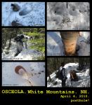
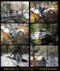
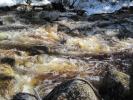
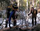
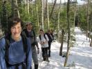
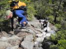
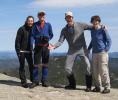
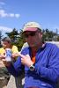
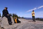
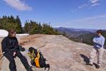
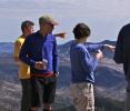
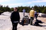
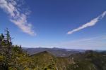
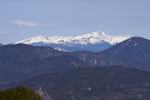
(April 4, 2010) The 2nd Annual Easter Expedition.... After breakfast at White Mountain Bagel we hit the Greeley Pond Trail around 9am. Then onto the Mt. Osceola Trail and over the summit of East Osceola to Osceola. 7.6 miles roundtrip. No sweat. (Least it seems that way now.) Big Nude & Kate crossed a couple off their list, Bob, Chrissy & I had been here before.
An interesting dynamic, warm weather (sunny in the 60s) but winter trail conditions. Quite a difference from last Easter's trip - no galeforce wind or 10° temps. Hiked in a t-shirt today. Some challenging river crossings due to the torrential rains we've had in the Northeast. Postholing galore. And a whole lotta steep-age on these here mountains. Kickin' steps in the snow was taxing, but scamperin' hand over foot on pitches like the Chimney was exhilaratin'. Early on we made a treacherous crossing of the Raging River of Death. One false step, and it was curtains. But, in the end, after a quick headcount, everyone made it. The trek was a blast, and this fine crew of mountaineers enjoyed the hell out of it.
.:: 2005 OSCEOLA (4340') & EAST OSCEOLA (4156') EXPEDITION ::.
(May 14, 2005) On a pleasant overcast day in May, Matty and JB bagged a coupla beautacious peaks in the Sandwich Range. Another classic trail, not long in distance, but some serious elevation gain and great rock scampers. Took the Greeley Pond Trail (from the north off the Kanc) to the Mt. Osceola Trail. East Osceola (#33, 4156') has a wooded peak but some nice views on the way. Some serious steepitude on the col between, then onto Mt. Osceola (#23, 4340').
Osceola, named after the Seminole chief, is the highest of the Sandwiches - unless, of course yer talkin' about Mamma Maz's Monster Meatball Sandwich. The Chimney, a short steep funnel of loose rock separates the men from the boys. The manly-men then celebrated the summit with a Smuttynose IPA and a sandwich. Watched a storm roll in on Mt. Washington. On the retreat we hoofed over to Greeley Pond. Pretty pond. Scouted out some nice tentsites.
.:: 2011 ::.
.:: 2011 MT. WASHINGTON: WHITE MOUNTAIN WEDDING ::.
(June 25, 2011) On this fine foggy day, Chrissie & Bob got hitched atop Mt. Washington. Seven mountaineers (Chrissie, Bob, Kate, Mike, Tiffany, Reverend D, & JB) hit the trail at 7am. A great loop: Ammonoosuc Ravine Trail & Crawford Path, then the Westside Trail & Jewell Trail on descent.
Overcast day, seven knuckleheads (including Chrissie & Bob, who were soon to wed) pushed through the mist that was gathering on the shoulder of Mount Washington. Reverend D blessed our journey (with the power vested in him by the State of New Hampshire and the Church of the Dude) and we had a fine hike. Hiking on Mt. Washington is rugged. It's a huge sprawling mountain, 6288' last time I measured my feet.
Eventually we reached the pinnacle, and soon after kinfolk and friends were disembarking the Cog Railway. Everyone gathered in the Tip Top House and Reverend D commenced the service. "With the power vested in me by the State of New Hampshire and the Church of the Dude, whaddya gonna do?" They said, "Ya can't do nuttin' so we're gonna get hitched." And so it was. Very cool ceremony incidentally, with parents and siblings hauling stones, building a cairn. Unique. Best wedding I've ever been to.
I did a lot of filming of the hike, pre-hike, ceremony, celebration and descent. Unfortunately the ceremony footage is not available. If we can find it, the film will be complete. And available. For the low, low, superlow price of... FREE!
/\
.::/48\::.
.:: 2011 Isolation (4005') ::.
(September 10, 2011) Mt. Isolation has been tagged and bagged by Kate, Big Nude, Chrissie, Peru & JB. As fine a day in the mountains as you'll see, but a very tough haul, lots of gain in the first few miles. 13.2 miles in around 8 hours. Had me some Sixpoint 'The Crisp' on the summit. And a PBR for the hike down... Then Moat Mountain Brewery for the celebration. Jeez, I think the beer part was actually harder!
This incredible loop started around 10:15am, an hour or so later than we planned because of the d and over the summit of amage done by Hurricane Irene. The Glen Boulder Trail, Davis Path, IIsolation Trail, to the Rocky Branch Trail. Someone called this trek 'toploaded', and it was for certain - tremendous gain in the first few miles on the Glen Boulder Trail. Pretty much from the get-go. When it finally opens up, GOODNESS GRACIOUS! What we live for up in these here Whites. The Glen Boulder Trail is on the shoulder of Mount Washington, the views are spectacular. And the climb tops out at over 5000' only to descend to the peak of a 4005' mountain.
Gots to fess up - Mt. Isolation was my 48th peak in White Mountains. Took awhile for this one, #45, 46 & 47 were bagged on our Bonds Traverse, September 30, 2007. So almost 4 years. Now I got 'em all, I can retire to the couch! Glad my favoritest hikers (and great friends) could join me - the exceptions being MD & Sherry. Something having to do with Ivy Bean, their new baby. I say, c'mon folks, let's have some priorities here... Christ.
Not many mountaineers on the trail on this day, but when we reached the summit, there was a herd of hikers atop enjoying their lunch and conquest. The Nudz & Peruvians shuffled 'em all away to take a summit picture of me, announcing my milestone, and I was greeted with applause. "Please, no autographs," I pleaded. Really nice... And we had a fine time on the mountaintop - lunch (turkey & roasted red peppers sandwich from White Mountain Bagel for me) paired well with a Sixpoint Crisp, and, as the Peruvians were in a bit of a rush, a PBR to start the hike down.
We stopped again at a stream crossing for a bite and a beer. As the Perus pushed onwards. Amazing was the damage done by Hurricane Irene. A good break, I think we all needed some fuel. Caught the Peruvians on the last leg and next thing we knew we were bellying up to the bar at the Moat Mountain Brewery. On a scale of 1 - 10, this goes to 11.
(February 5, 2012) The long anticipated film, "White Mountain Wedding", was finally completed, with a puppet show mimicking the unavailable ceremony footage. Premiered prior to the game on Superbowl Sunday, before the Giants once again defeated the Pats by a score of 21-17. Lotsa laughs, a few tears (mostly when the keg kicked at halftime.)
.:: 2011 Lincoln & Lafayette (5089' & 5260') ::.
(June 18, 2011) Falling Waters, Franconia Ridge Trail, and the Greenleaf to the Old Bridle Path goin' down. Nice day with clouds rollin' in and out. Some blackfly action when the wind stilled. Had to cut out my lunch on their account. One of the great ridge hikes in the Whites.
.:: 2011 Pemigewasset (2557') ::.
(Thanksgiving, November 24, 2011) Mount Pemi. Thankful for many things, especially thankful that I have not had to go through the sh!t many on our fine planet have. I'm also thankful that I've had some fine treks in the wilderness, and walks in the woods. Many this summer and fall. And thankful that on this day this year I had no obligations and was free to do what I pleased. (Which is pretty much how I run my life. I love freedom.)
Took the Mt. Pemigewasset Trail from the Flume parking lot. A short one, 3-4 miles all-told, to the summit of Pemigewasset. Overcast, about 6 - 8 inches of snow on the trail, barebooted it in maybe 2 hours. Nice sprawling summit with maybe 180° views. Planning on taking the Indian Head Trail down for a nice loop, but my head was down and I missed the cutoff. Winter has arrived in New Hampshire.
the prequel.... Arrived at Lincoln as my pumpkin-wheat pancake breakfast ran it's course. I was STAHHHVIN! BWell,BBB I put my thinkin' cap on and, since I was wonderin' whether the Woodstock Inn & Brewery would be open today, I checked it out. Had me a fine turkey dinner with all the trimmings (only thing on the menu) and a Pemi Pale Ale.
.:: 2012 ::.
.:: 2012 Moosilauke (4802') ::.
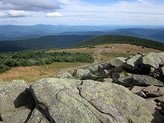
(August 19, 2012) Hard to believe it's been 8 years since I first climbed Moosilauke with MD, Tiffany & Skip. In the early spring of '04, we experienced winter-like conditions, not brutally cold, but snow covered. Boot-skied down.... Quite different in the summer. Beautiful cascades on the first mile or so upward. Much is gained early here. Steps and handholds bolted into the bedrock make things easier as negotiate some steep pitches. A hearty climb of 7.6 miles, 3100' gained. Tough trail, rocky and top-loaded - serious climbin' fer the first coupla hours our so. My tootsies were whinin' a coupla days after....
Hit the Beaver Brook Trail (part of the Appalachian Trail) at 1pm, on a perfect 70° day. The Beaver Brook Cascades were flowin' vigorously. At about the halfway point, a lean-to and tentsites, and "the Privy of Illusion" are available slightly offtrail. The last half mile to the open summit is worth the price - 365° views and a beautiful spot to take lunch (a White Mountain Bagel turkey & roasted red pepper sandwich on wheat) and a brew (Ipswich Harvest Ale). Took me 2:45 to the summit, 1:45 down to the parking lot.
.:: 2004 Moosilauke (4802') ::.
(White Mountains, April 18, 2004) The 2004 Moosilauke Expedition was a fine one. Mt. Moosilauke (4802') is the 10th highest in the Whites. The mountaineers (Tiffany, Skip, Matthew, JB), all climbing Moosilauke for the first time, took the Beaver Brook Trail (a part of the Appalachian Trail) out and back - about 7.6 miles alltold. (Incidently, my writing beverage is presently Tuckerman Pale Ale, bottle-conditioned, brewed in Conway, NH, and most excellent.)
Another early spring hike, perfect weather, cloudy in the 50's, still maybe 3-4 feet of snow on the trail, as there was on Eisenhower a coupla weeks back. The Beaver Brook Trail is a scenic one, but the first mile or so was pretty hairy. Icy and steep, we tried to avoid the tragic consequences of which we were duly forewarned. The trail is perched upon the endless Beaver Brook Cascades - one false step and it was CURTAINS!! CURTAINS I tell ya... certain death! But that certain curtain call would have to wait, as we hammered upwards, kicking steps into the ice. (Bringing up the rear I simply followed the stairway my colleagues broke for me, lazy bastid, but don't tell them that...) Some postholin' later, we broke treeline (and snowline) and hit summit.
Lunched atop Moosilauke with maybe a dozen hikers and several dogs, including a rambuncious retriever who damn near retrieved my sandwich. Tragic consequences indeed!
The mountain gods must like us or something, because the hike down was SLAMMIN'. Bootskiin' down on much of the trail, as the sun had softened the icy path. Matty and Tiff were hammerin' down, Skip and I followed in their wake. What a blast. Dessert after a fine meal - slidin' boot down the mountainside. (I done done it once out west years ago, but it's still a new experience.) We won't pass up hiking this time of year again... Anyhoo, after a quick head count at the bottom of the mountain, casualties were under 50%. Collateral damage: we ain't sayin'... -- JB
.:: 2012 Tecumseh (4003') ::.
(April 14, 2012) First hike of the year for us, Tecumseh cracks the 4000' club with 3 feet to spare. Kate, Big Nude & I hit the aptly named Mt. Tecumseh Trail at 8am from the Waterville Valley parking lot. Some snow and ice but we bare-booted with no problem. Perfect clear day, 5 miles roundtrip. A nice easy one to start the season. #38 for the Nudz. I hiked this one before, way back in '04. It's really a nice hike through gorgeous pine forest, and the view from the top on this fine day was something.
The snow capped Presidentials stood out, as did the Tripyramids. Still true winter conditions there. The only setback was a disastrous field test of the Fishbrook Pond Imperial Saaz. I plopped it in the snow (on the summit) to take a promo shot, got the picture, then, like a Korean long-range missile, it nosedived upside down into the snow below. Managed to salvage a few slugs, but it was not a successful field test. Not at all.
Took the Sosman Trail down on the recommendation of Rocket21, who knows these trails like no one's business. A bit over a half mile of winding path, with some nice windows to the mountains. Then it connects with the Waterville Valley ski paths, which were pretty hard on the ol' thighs.
Then it was onto Portsmouth, where yours truly (and 10,000 others) received commendations for mountaineering achievements. There was a little girl, no more than 7 years old, who had climbed all 48 IN WINTER. So I didn't feel quite as good about meself.... The high point for us (no pun intended) was the use of Big Nude Mike's Group 5 tune, "I Climbed Every Mountain" in the slide show celebration.
.:: 2013 ::.
.:: 2013 Pack Monadnock (2290') ::.
(May 27, 2013) First hike of the season for me, and a very nice one despite the parking lot on top. Took the Marion Davis Trail up and Wapack Trail down. No bugs, or mud to speak of on this perfect day. Climbed the fire tower for some fine views. Only 2.8 miles roundtrip, but 800-900 feet of gain, so a nice little hike.
.:: 2013 North Twin Trail ::.
(August 3, 2013) A coupla hours on the trail, no summit. Why would I? I got 'em all! Drizzly whist hikin', cleared beautifully as I reached the parking lot. Dem's da breaks. The trail follows the Little River for several miles before climbing towards North Twin. Last time on this trail was the Bonds Traverse, quite a different thang than todays mindless wandering. Took some pics and enjoyed a bomber of Lonesome Shoe Spiky IPA on the river. Retired to Woodstock Brewery for dinner, Pemi & IPA, then scooted to the Robinwood for Pete's B'Day celebration.
.:: 2013 Jefferson (5712') ::.
(August 11, 2013) Cue in the Beatles: "It was 30 years ago today, Jimmy Spil showed us all the way...." Sho' nuff, 30 years ago I hit the Caps Ridge Trail for the first time.
Stepped out around 12:30pm today, which worked out perfect. Some weather passing through up there, and a coupla hours earlier it was socked in. The JB Magical Formula (start late when applicable!) does it again. Hadn't climbed the Caps Ridge in many years. It's only 2˝ each way, but talk about bang fer yer buck - lotsa hand-over-foot scamperin' and gain. I ventured out on some rockface pretending I was Messner or Hillary or someone. Another hiker commented, "You took the hard way. But there's no easy way."
"For a short trail," I says.... "SHORT? You must be a local!" she responds. Ain't a local, though I wouldn't mind bein' one, and it is but 2˝ miles up. But there's some serious bang fer the buck here. Some real rock-grabbin' and elevating that starts pretty much from the outset.
Very cool hike on a perfect mountain day. Nice view of Washington when you get to the Caps. The weather scrapes that mountaintop like no one's business. But it too had cleared by the time I was standing on the summit (of Jefferson). Adams, another favorite, looked massive and majestic today. Celebrated the summit with a bomber of Lonesome Shoe Spiky Shoe IPA and a Clif Bar.
(August 25, 2013) We did this in 2005, and on my return reversed the classic loop: Elephant Rock, Cascade, Livermore, Mt. Tripyramid Trail up South Slide to the South Peak (4100'). Then north to Middle Trypyramid (4140') and North Tripyramid (4180'). The Scaur Ridge Trail for the descent. Added several miles to my day as the network of cross-country ski trails is rather confusing. Maybe 15 miles on my blistered foots today. Very tough trails up this mountain, and descending the North Slide woulda been a bad move for me I think. Clear blue day in the 70s. .:: 2013 Tripyramids ::.
2015
.:: NOON 2976'. JENNINGS 3450'.SANDWICH DOME 3993'. ::.
(September 6, 2015) Took the Sandwich Mountain Trail up, the Drakes Brook Trail on descent. 8.6 miles roundtrip.
2016
.:: LIBERTY 4459'. ::.
(August 27, 2016) Mount Liberty by the Whitehouse Trail, Liberty Spring Trail, to the Franconia Ridge Trail. There and back, solo no oxygen, about 8-9 miles roundtrip. With 3250' of gain, no wonder my legs are sore. My all too usual late 2pm start had me on the summit around 5pm. This was a blessing, as on the way up I passed maybe 40 folks descending. I had the summit to myself for a half hour, had a snack and a Moat Mountain Intervale IPA and took some shots. Nice early evening shadows. As I descended, some folks were apparently headin up for the sunset from the nearby Liberty tentsite. 2nd time atop Liberty, first time by this route.